

Oil spill.
Visual Intelligence collaborates with Kongsberg Satellite Services (KSAT) who are experts on satellite imagery. Using their SAR satellites, they are able to capture images of earth's surface both day and night, regardless of weather conditions.
These unique images enable rapid monitoring of the oceans and the possibility to detect oil-spills. Visual Intelligence collaborates with KSAT to develop new models for detecting and characterizing oil spills.
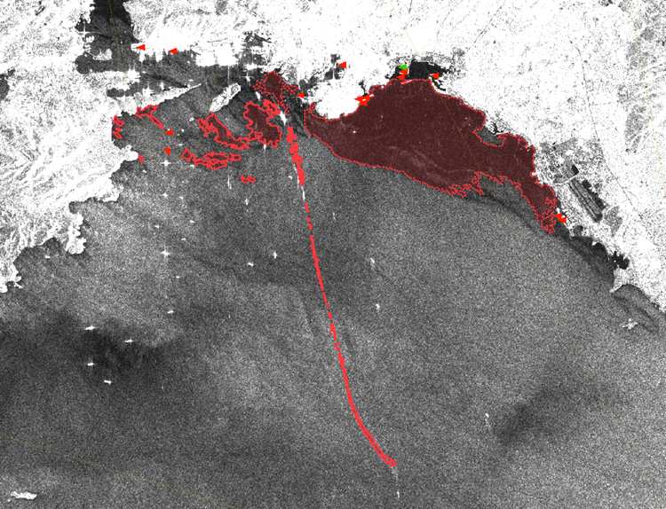
Despite KSAT's experence with oil spill detection there are several challenges related to the problem of oil spill characterization. The challenges are related to the scarcity of high-quality training data, a lack of large-scale annotated datasets, and difficulties related to the extraction of reliable information from heterogeneous datasets with different geometrical and statistical distributions as well as multiple spatial and spectral resolutions.
It is crucial to develop new frameworks for data analysis that can tackle these issues, to provide reliable and accurate information on the detected oil spills. Deep learning can hence play a key role in this sense, so to provide robust and efficient characterization of the oil properties in the ocean.